
USA Wall Map 24″x36″
$35.99
Only 5 left
In stock
Overview
• Laminated Surface: Durable lamination protects the map from wear and tear, allows for dry-erase marker use, and makes it easy to clean and maintain for long-term use in homes, offices, or classrooms
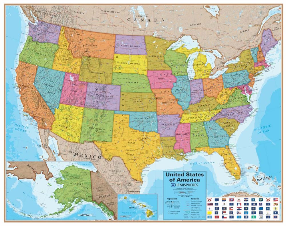
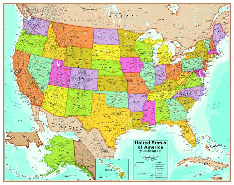
• Detailed Geographic Information: Features thousands of labelled capitals and cities, complete U.S. Interstate Highway system, state boundaries with colour-coded states, and clearly marked points of interest for comprehensive reference
• 24″ x 36″ Dimensions: Large format provides excellent visibility and detail while remaining practical for wall mounting in standard spaces
• Blue Ocean Series Design: Distinctive blue ocean styling enhances visual appeal and makes coastal boundaries and waterways easy to identify at a glance
• Reference Legend Included: Built-in legend helps quickly identify map symbols, highways, landmarks, and other geographic features without guesswork
• Educational and Practical: Serves as a functional reference tool for trip planning, geography studies, business logistics, or tracking travel destinations across the United States
ASK A QUESTION
Report an issue with this productFind it in our store:
You may also like


Details
The Waypoint Geographic blue oceans laminated USA map is an excellent addition for your home, office, or classroom. In addition to well-appointed state colour coding, state boundaries, you will find thousands of Capitals & Cities, miles of U.S. Interstate Highways, and many others clearly labelled for easy reading. The map also includes an easy-to-reference legend to assist in identifying the information you are looking at. Measures 24″x36″
Product Information
Additional Details
| Audience |
Teachers |
|---|---|
| Book Category |
School – Teaching |
| Brand |
Customer Reviews
Add a review
You must be logged in to post a review
Log In
0%
0%
0%
0%
0%
0 of 0 reviews
Sorry, no reviews match your current selections
$35.99